Soft ridges, morning fog, soup at the hut on top, and light worth waiting for.
The blue trail to Klimczok passes the sanctuary on Górka, about 300 m from the residence. From the centre of Szczyrk, marked trails climb to Skrzyczne, the highest summit of the Beskid Śląski. Then the ridges: mountain huts, wide views, and still forests where deer, foxes and mountain birds live.
Eight easy steps, from the first question to the last light. The nearest marked trail: Szczyrk, Sanktuarium (Na Górce), 672 m, 0.29 km from the residence in a straight line. Everything was checked on the official websites; where we could not confirm a detail, it says “check before visiting”.
You set out in the afternoon, a head torch in the pack, because in the mountains dusk comes quickly. The blue trail starts by the sanctuary on Górka, a short walk from the door, and climbs through the forest towards Klimczok.
Read the story
Higher up the trees open, and across the valley Skrzyczne stands with its mast against the sky, the whole of Szczyrk lying between you. The stone hut on the slope of Magura has a story worth the climb: the hut before it burned down on its opening day in 1895, and again in 1910 and 1913. In 1914 it was built anew in stone, and it still stands.
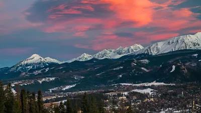
From the summit, 1,117 m, the open view is to the south-east, where on a clear day the Tatra peaks rise beyond the ridges of the Beskid Żywiecki. Then the blue hour comes: about half an hour when the sky is deeper than the land and the first lights come on in the valley.
You switch on the torch and follow the blue marks down, slowly, towards the lights of home.
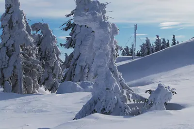
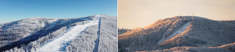
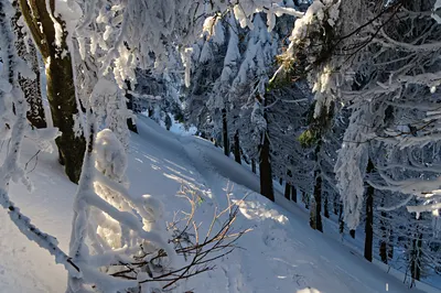
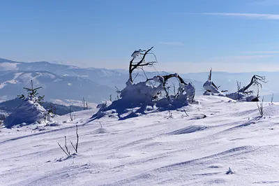
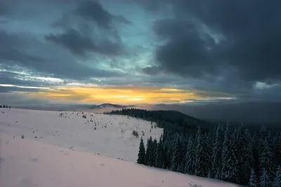
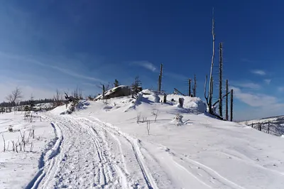
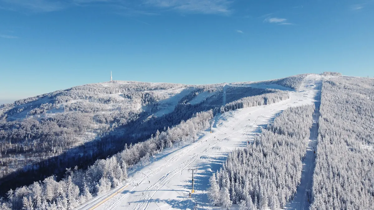
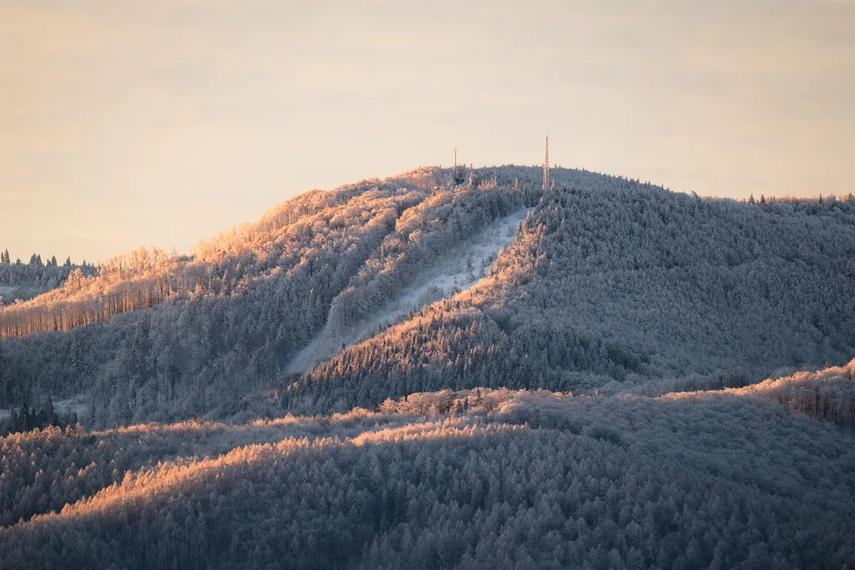
Skrzyczne in winter: the ski run below the summit and its mast Photo: Max Cyprys · Unsplash License · colour-graded by ChikApart·Klimczok’s ridge in winter: the frosted forest of Szyndzielnia at sunrise Photo: Krzysztof Kowalik · Unsplash License · colour-graded by ChikApart
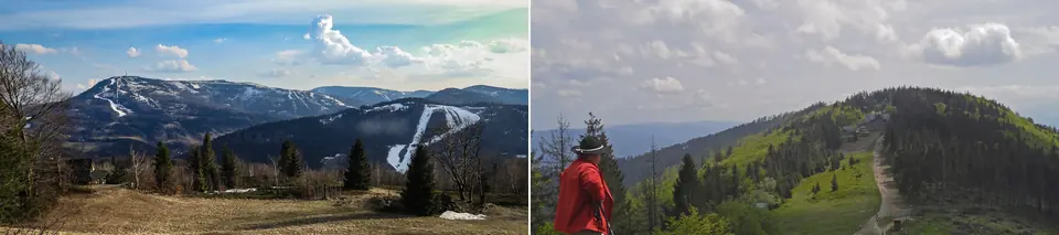
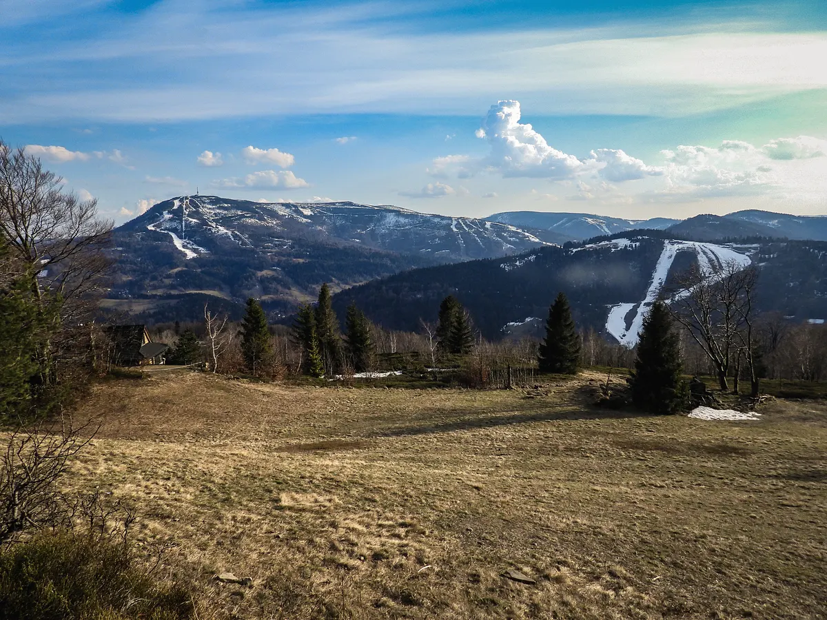
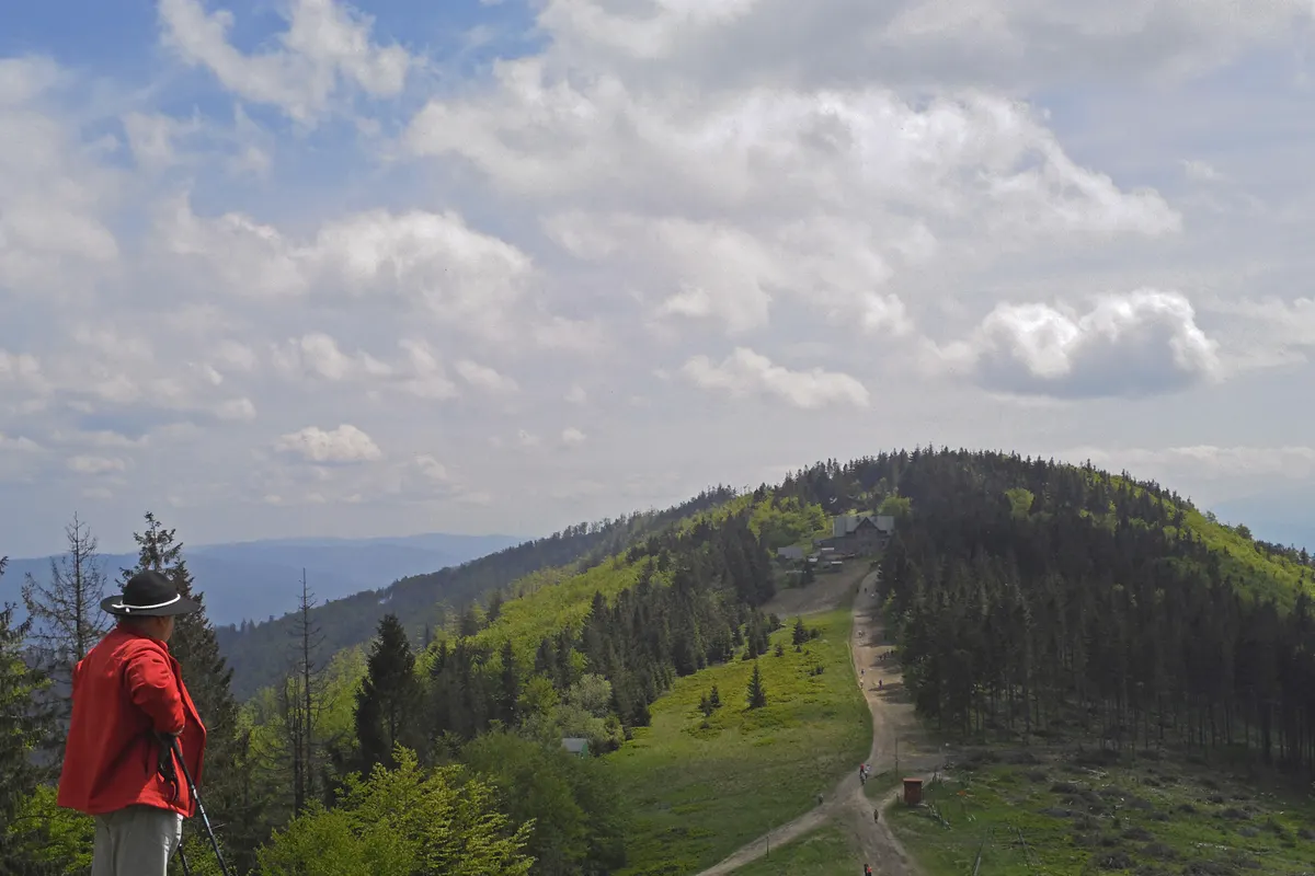
Skrzyczne in early spring: snow left only on the ski runs Photo: Jendrusk · CC BY-SA 4.0 · colour-graded by ChikApart·Klimczok in May: the summit meadow and the hut Photo: DagmarLubczanski · CC BY-SA 3.0 pl · colour-graded by ChikApart
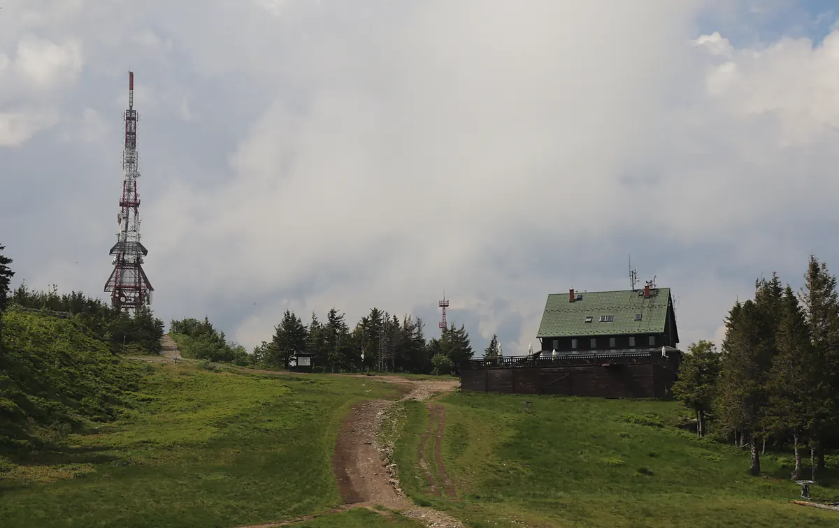
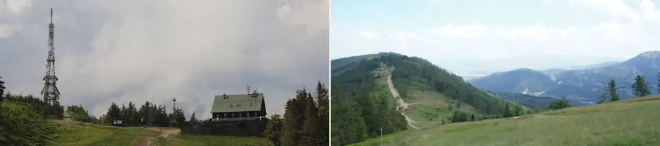
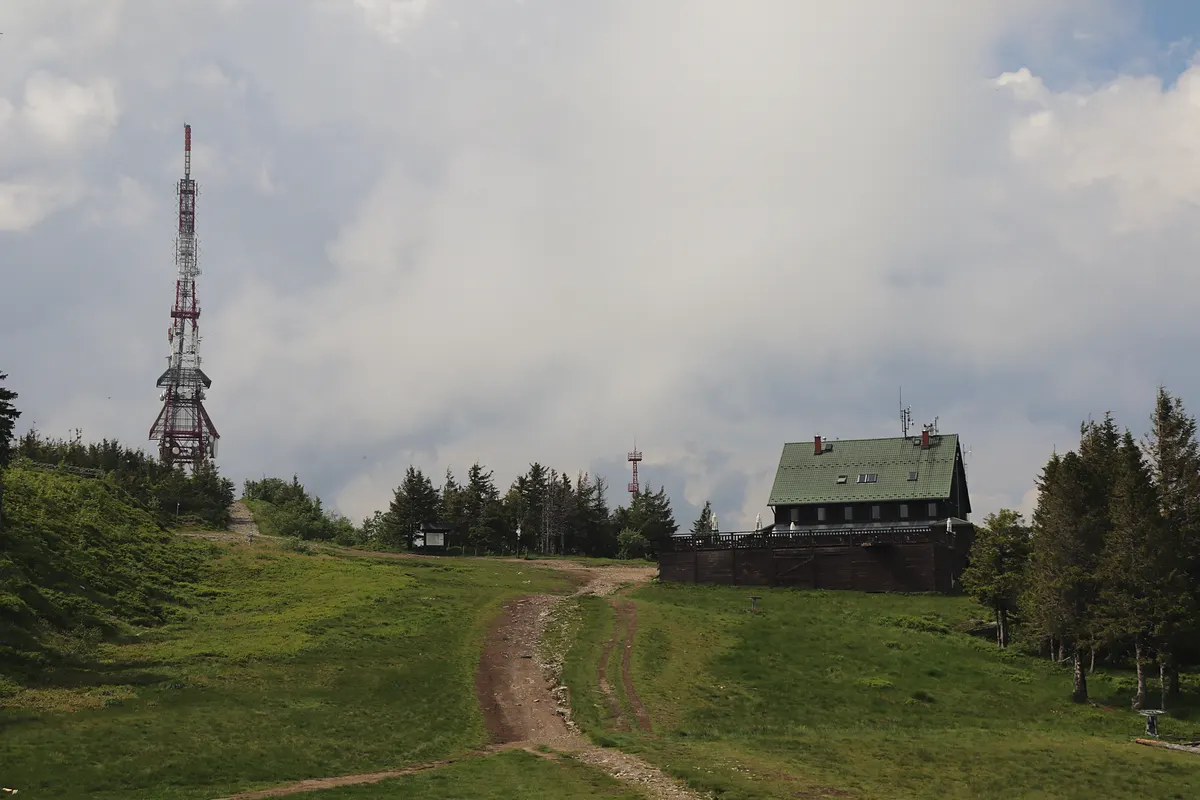
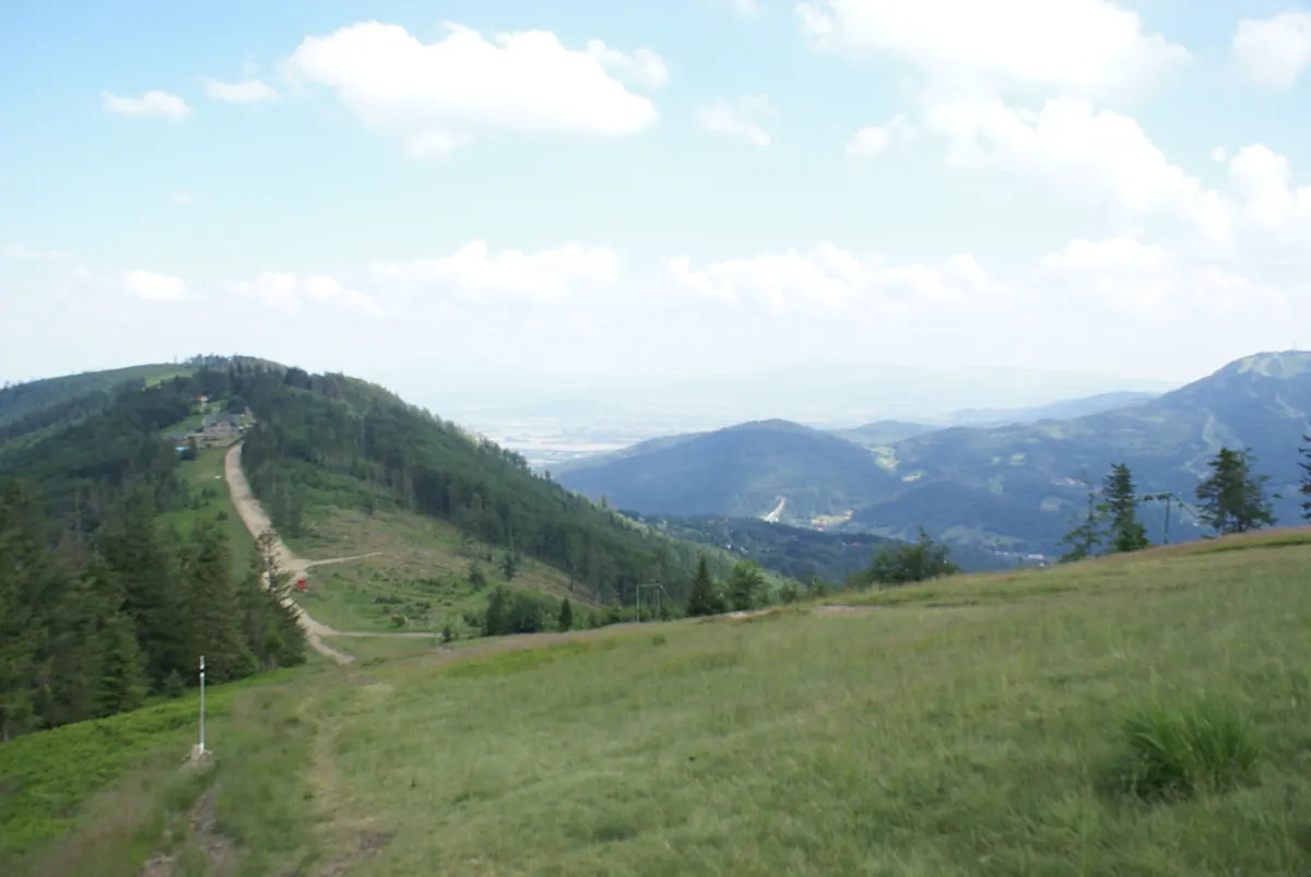
Skrzyczne in June: the mast and the hut on the summit Photo: Andrzej Otrębski · CC BY-SA 4.0 · colour-graded by ChikApart·Klimczok in June: from the summit meadow down to the hut Photo: Buczkowiak94 · CC BY-SA 4.0 · colour-graded by ChikApart
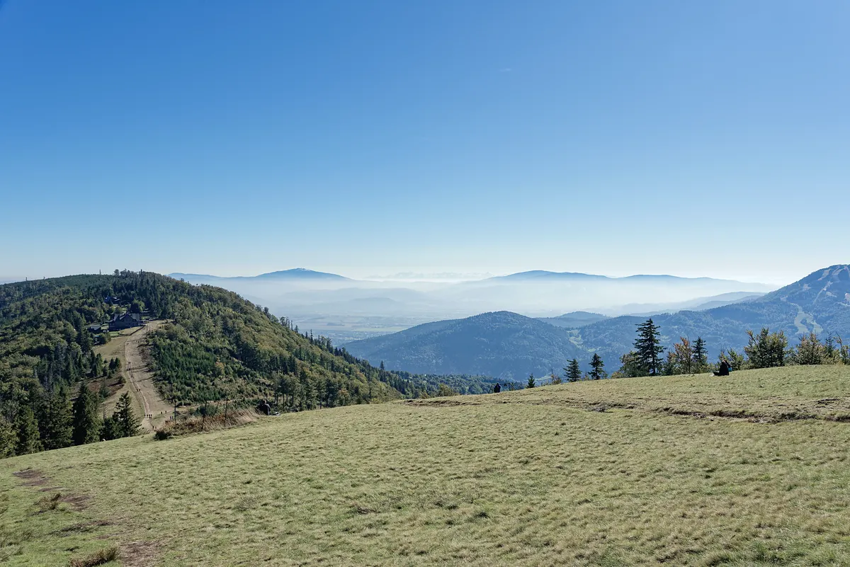
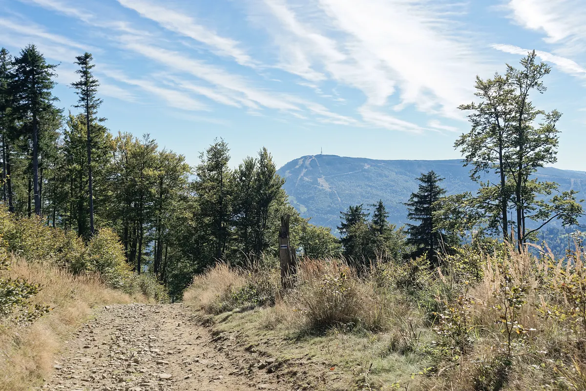
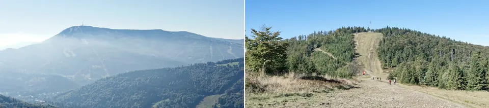
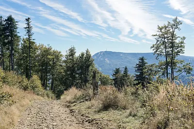
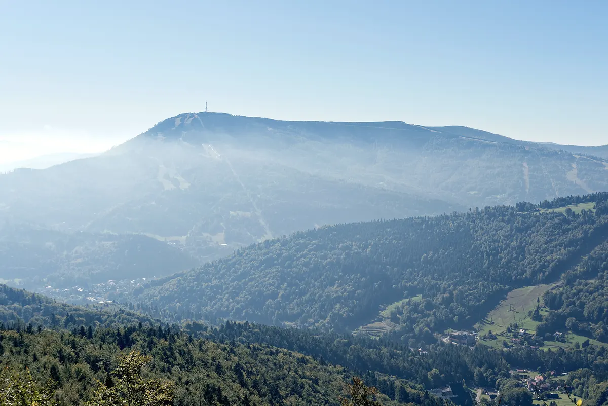
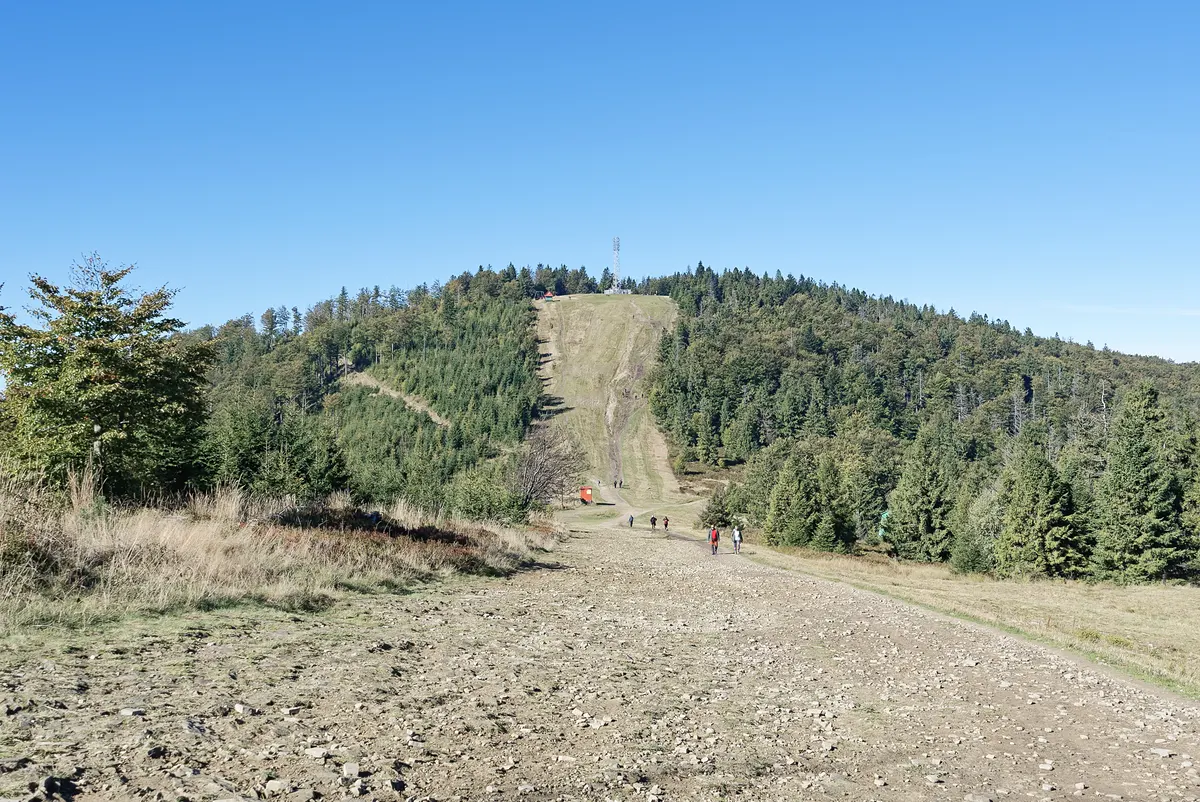
Skrzyczne in October, seen from the trail to Klimczok Photo: Jakub Hałun · CC BY 4.0 · colour-graded by ChikApart·Klimczok in October: the path to the summit Photo: Jakub Hałun · CC BY 4.0 · colour-graded by ChikApart
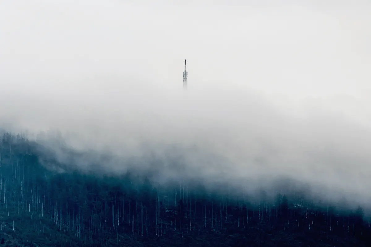
Skrzyczne, 1,257 m: the mast above the clouds Photo: Krzysztof Kowalik / Unsplash · colour-graded by ChikApart
Skrzyczne is the frog. At 1,257 m it is the highest peak of the Beskid Śląski and one of the Crown of Polish Mountains. Its 87-metre mast is seen from half of Silesia. It is the easy one: a two-stage chairlift leaves ul. Myśliwska, changes at Hala Jaworzyna and sets you down almost at the top. The PTTK hut there, at about 1,250 m, is open all year.
The name, says Andrzej Komoniecki’s eighteenth-century chronicle, the Dziejopis Żywiecki, comes from the croaking of frogs in a pond in the hollow below the summit. The pond is long gone; a frog still sits on the top, by the mast. On very clear days you can see the Tatras from there.
Klimczok is the phoenix. At 1,117 m it is the walkers’ mountain, and its hut stands on the slope of Magura, about 700 m from the summit. In 1872 the wooden Klementynówka stood there, a shelter used mostly by hunters. The Beskidenverein enlarged it in 1894–95, and on its opening day, 5 May 1895, it burned down. Rebuilt, it burned again in 1910, and again in 1913. In 1914 it rose in stone, and that hut still stands.
Both begin close to home: the blue trail to Klimczok passes the sanctuary on Górka, about 300 m from the residence. The chairlift to Skrzyczne leaves from the centre of Szczyrk. At the end of the day, a warm home waits below.
The highest peak of the Beskid Śląski; one of the Crown of Polish Mountains.
Up
The two-stage chairlift from ul. Myśliwska 45, changing at Hala Jaworzyna, or the marked trails. The lift pauses for its inspection in November: check before visiting. The trails, step 2
The hut
PTTK Skrzyczne, at about 1,250 m, just below the summit; open all year. The hut card
The frog
A frog statue on the top, by the mast: the name, says the old chronicle, comes from croaking frogs.
the phoenix
Klimczok 1,117 m
Details
The hut
On the slope of Magura, about 700 m from the summit. The hut card
1872
The wooden Klementynówka, a shelter used mostly by hunters.
1894–95
Enlarged by the Beskidenverein; it burned down on its opening day, 5 May 1895.
1910, 1913
Rebuilt, and burned twice more.
1914
Built anew in stone. That hut still stands.
Up
The blue trail from the sanctuary on Górka, about 300 m from the residence. The blue trail
The two mountains, in profile
Heights are to scale; distances are not.
5007501,0001,250 m12 min8 min2 h 30 min2 h 10 min12Klimczok1,117 m3Szczyrk460–600 m45Skrzyczne1,257 m67
Heights and times as their official pages print them, read on . Other maps print 1,052 m for the hut on Magura; the profile shows the regional tourist organisation’s 1,034 m.
Skrzyczne, the frog
Whereabout 4 min by car
When
The Skrzyczne chairlift
Winter and summer; it pauses for its inspection in November, and between the seasons: check.
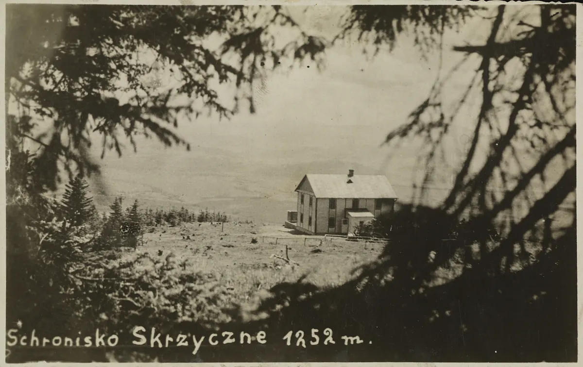
Not the same building: the hut of 1933 burnt in the mid-1930s, its replacement was looted in 1945 and rebuilt by PTT, then PTTK (reopened in 1950, a new roof in 1998). The same summit meadow; the mast came with the lifts, after 1958.
Then: The Skrzyczne hut on a postcard of 1936: Rudolf Urbanke’s wooden hut of the 1930s on the summit meadow Photo: Unknown author (postcard) · Public domain (Polona: Domena Publiczna) · the postcard as scanned
Today: The PTTK hut on Skrzyczne today, the television mast beside it, 2022 Photo: Andrzej Otrębski · CC BY-SA 4.0 · colour-graded by ChikApart
Then and now: the hut on Klimczok
ThenToday
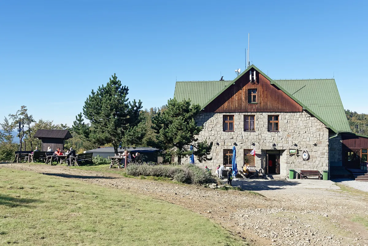
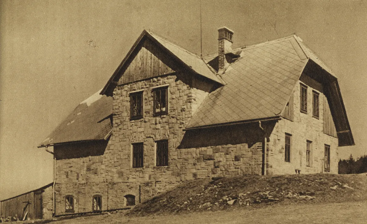
The old postcard reads “Schronisko na Magorze … Własność B. V. Bielsko”: the hut on Magura, property of the Beskidenverein of Bielsko. Today it is the PTTK hut on Klimczok, photographed in October 2025.
Then: The stone hut on Magura on an old postcard: “Schronisko na Magorze”, property of the Beskidenverein of Bielsko Photo: Unknown author, published by „Bazar Papierniczy” L. Sterling i H. Fleissig, Bielsko. · Public domain · colour-graded by ChikApart
Today: The PTTK hut on Klimczok today, October 2025 Photo: Jakub Hałun · CC BY 4.0 · colour-graded by ChikApart
Klimczok, the phoenix
Whereabout 5 min on foot
When
The marked trails
All year, in daylight; in winter short days, ice and snow on the ridges.
Not sure where to go? Choose the question that sounds like your day, and follow the arrow. Every trail here is waymarked with painted stripes on trees and stones; the colour tells you which trail it is, not how hard it is.
From the centre up the quiet Biła valley to Chata Wuja Toma at Przełęcz Karkoszczonka. 2.9 km: about 1:07 up, 0:44 down (szlaki.net.pl). Lunch at the top.
Skrzyczne loop: up the blue trail along the chairlift to the PTTK hut on the summit (5.1 km, about 2:28). Down by the green trail via Becyrek (about 1:16). Not in winter: the blue shares the slope with skiers.
Klimczok ridge loop: the blue trail from the sanctuary to the Klimczok hut, then the red ridge south to Przełęcz Karkoszczonka (2.2 km). Down to Szczyrk by the yellow trail.
Klimczok summit: its open view is to the south-east, where the Tatras rise above the Beskid Żywiecki. Walk up the blue trail from the sanctuary with a head torch, or sleep at the Klimczok hut and step out at dawn.
Eleven marked trails start in Szczyrk or pass through it. Two leave from the sanctuary on Górka, about 300 m from the residence; two more from the centre. Figures are as the trail portals publish them, walking time without stops.
Whereabout 5 min on foot
When
The marked trails
All year, in daylight; in winter short days, ice and snow on the ridges.
How longAbout 2 h 15 min up Klimczok
How muchFree
Who forEach trail says how hard it is
A story
Follow the colour
A painted mark on a beech trunk is all the guidance you need. The colour names the trail, never how hard it is: read its card before you choose.
Read the story
Lace up boots you have already walked in. Put water, a rain jacket, a map and a charged phone in the pack.
Then follow the blue marks uphill until the roofs fall away below you, and the only decision left is whether to stop at the hut or go on to the top.
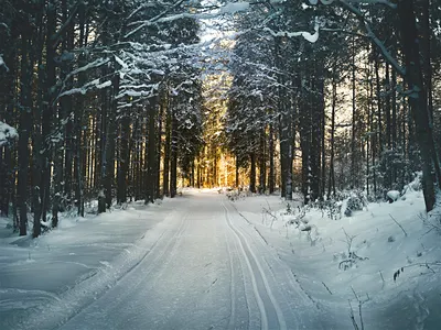
A forest path on the slope of Barania Góra in winter, Beskid Śląski1 / 14
Photos 14
From the doorstep
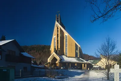
The sanctuary on Górka, about 300 m from the residence in a straight line.
Blue trail
Blue trail · Wilkowice – Lipowa, Ostre
21.5km
7:50hours there
1428 mascent
moderatedifficulty
Wilkowice · Bystra · Schronisko PTTK Klimczok · Siodło pod Klimczokiem · Na Pięciu Drogach · Szczyrk Kosajonka · Szczyrk Sanktuarium (Na Górce) · Szczyrk centre · Szczyrk dolna stacja kolejki (Skrzyczne chairlift) · Polana Jaworzyna · Skrzyczne · Lipowa, Ostre
Details
Time 7:50: Wilkowice → Lipowa Ostre (mapa-turystyczna.pl estimate). Time back: not published.
Start here
Szczyrk, Sanktuarium (Na Górce) · about 300 m from the residence in a straight line · Google Maps
The walk
Join it at the sanctuary: uphill to Klimczok, downhill to the centre and on to Skrzyczne.
From Szczyrk, both ways
Szczyrk centre – Szczyrk Sanktuarium – Klimczok (uphill) — 4.8 km · 2:15 there · 1:15 back · ascent 606 m
Szczyrk centre – Jaworzyna – Skrzyczne (uphill, along the chairlift) — 5.1 km · 2:28 there · about 1:15 (slaskiemiasta: ~75 min down) back · ascent 743 m
Szlak im. Stanisława Huli (Skrzyczne – Małe Skrzyczne – Malinowska Skała – Przełęcz Salmopolska – Kotarz – Karkoszczonka – Klimczok, ~31 km, ~11 h) is described by szczyrk.com as a route of mixed colours: it follows the red and green trails above and has no colour of its own.
Beskidzka Droga św. Jakuba (pilgrim route) passes Szczyrk Sanktuarium, Szczyrk Biła, Przełęcz Karkoszczonka and Jaskinia Dująca (mapa-turystyczna.pl node pages); not a PTTK colour trail.
OpenStreetMap also shows a local blue route, Jaworzyna (Szczyrk centre – Jaworzyna, 3.4 km), and the local loops Beskid and Wokół Centrum; they are not PTTK trails, so they are not listed here.
A feature · the forest at the edge of the residence
The landscape park
The forest that begins where the residence ends has a name: the Beskid Śląski Landscape Park. Its 386.20 km² of protected mountains hold Skrzyczne and Klimczok.
Since 1998 almost the whole of the Beskid Śląski has been one protected landscape. Most of it is forest: 337.71 km² of the park’s 386.20. The great summits stand in it: Skrzyczne 1,257 m, Barania Góra 1,220 m, Malinowska Skała 1,152 m, Klimczok 1,117 m.
Read the story
It keeps quieter things too. The Vistula, Poland’s longest river, begins here, in the streams Biała and Czarna Wisełka under Barania Góra; on the Biała Wisełka the water comes down 25 steps of rock, the Rodło Cascades. Under the ridges there are caves: the Malinowska Cave, 249.5 m long, the cave in Trzy Kopce with 1,257 m of passages, and the Ice Cave in Szczyrk itself. About 35 kinds of mammal live in these woods, deer, roe deer and wild boar among them, with the wolf and the lynx, and now and then a bear passing through.
A landscape park is not a fenced reserve. You walk in, on the marked trails, and the trails are the whole courtesy asked of you. Inside it eight small nature reserves guard what is rarest; they are named below.
A ski track on Magurka Radziechowska under a deep blue sky, Beskid Śląski1 / 11
Photos 11
Its eight nature reserves
Details
As the body that runs the park lists them. Stok Szyndzielni lies on the slope of Szyndzielnia, the mountain beside Klimczok.
Barania Góra379.85 haMountain mixed forest and the springs of the Biała and Czarna Wisełka, the beginnings of the Vistula.
Czantoria97.71 haLower-mountain forest of beech, sycamore and ash.
Stok Szyndzielni54.96 haBeech forest with sycamore, fir and spruce.
Dolina Łańskiego Potoku47.07 haStreamside forest, where the protected Veratrum lobelianum grows.
Jaworzyna40.03 haSycamore forest, the best kept of its kind in the Beskid Śląski.
Wisła17.61 haThe brown trout in its natural water, on the first stretch of the Vistula.
Kuźnie7.22 haRock formations on the slope of Muronka.
A mountain hut (schronisko) at the top of the climb is half the reason to go. Hours change with the season, as each hut prints them: check before visiting.
Whereabout 5 min on foot
When
The marked trails
All year, in daylight; in winter short days, ice and snow on the ridges.
A hut in these mountains keeps a simple promise: soup, a warm room, a bench in the sun. By the time you arrive you have earned all three, and that is the pleasure of it.
Read the story
On the Karkoszczonka pass, Chata Wuja Toma keeps its kitchen open every day from eight until five, with terraces for summer. On Magura the stone hut of Klimczok cooks the old home dishes and prefers cash, so carry some. And on Skrzyczne the hut just below the summit is open all year.
Sit down. The valley you climbed out of looks very small from here.
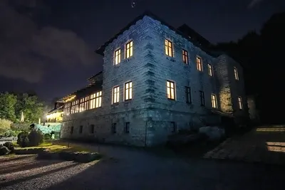
The PTTK hut on Szyndzielnia on a September evening, Beskid Śląski1 / 4
Schronisko PTTK Skrzyczne (Schronisko PTTK na Skrzycznem)
Check before visiting
1,250 m · about 4.1 km from the residence in a straight line
Dining room and buffet; beds for walkers who stay the night.
February 2025: on the night of 5–6 February 2025 an outbuilding next to the hut, with the grill bar and a store, burned down. The hut itself only filled with smoke: 22 guests were evacuated, returned, and the hut kept operating. Whether the grill bar has been rebuilt is not confirmed.
Details
Address
Skrzyczne summit, 43-370 Szczyrk (the hut lies in the municipality of Lipowa) · Google Maps
Trails
blue along the chairlift, green via Becyrek, yellow from the gondola, red and green from Malinowska Skała
Open
Kitchen Mon–Thu and Sun 8:00–18:45, Fri–Sat 8:00–19:45; buffet Mon–Thu and Sun 8:00–19:00, Fri–Sat 8:00–21:00 (its contact page; its menu page gives the buffet until 22:00).
Season
Open all year (PTTK).
Phone
+48 516 993 803 urgent matters only, says the hut; rooms by e-mail
1,001 m · about 4.1 km from the residence in a straight line
Rooms and home cooking; the Szyndzielnia cable car climbs from Bielsko-Biała. From its windows: the Żywiec Basin, Babia Góra, Pilsko and, in good weather, the Tatras (its site).
Details
Address
ul. Schronisko Szyndzielnia 8, 43-360 Bystra · Google Maps
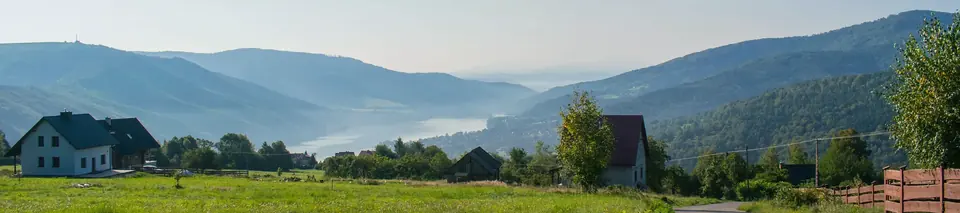
The Beskidy are soft mountains: long ridges, beech and spruce, and valleys that fill with fog. The pictures come to those who rise early or stay late. Here is when the light is low, where the views open on the trails, and what to carry.
Whereabout 5 min on foot
When
Valley fog at sunrise
Most likely from November to March, just before sunrise. Nobody can promise it.
How long30 to 40 minutes of blue hour
How muchFree
Who forA walk by head torch
A story
Waiting for the light
The best photograph of your stay may be taken before breakfast. On the shortest day the sun rises at 07:36 and is gone by 15:47; in June it is up at 04:33. Either side of it comes the blue hour, half an hour or a little more when the sky is deeper than the land.
Read the story
Look at the valley from your balcony at first light. If it is white with fog, which is most likely from November to March, go up: the summits will be standing in the sun above it.
Take a head torch, a small tripod and spare batteries kept warm in a pocket. Then wait. The light does the rest.
Wind-shaped snow on Magurka Radziechowska, Beskid Śląski1 / 57
Photos 57
The year of light
The fifteenth of every month in Szczyrk: when the blue hour begins, when the low gold light comes, when the sun rises and sets. In the valley the ridges hide the low sun a little longer: the light reaches the summits first.
Blue hour
Golden hour
Daylight
Night
Jan07:3616:09
Feb06:5617:01
Mar06:0017:47
Apr05:5419:35
May05:0120:20
Jun04:3520:53
Jul04:5120:48
Aug05:3320:04
Sep06:1819:00
Oct07:0317:55
Nov06:5416:03
Dec07:3415:44
06:0009:0012:0015:0018:0021:00
Every time, month by month
The 15th
First light
Golden hour
Sunrise
Sunset
Golden hour
Last light
Daylight
January
06:59
07:13–08:30
07:36
16:09
15:16–16:32
16:46
8.6 h
February
06:23
06:36–07:42
06:56
17:01
16:15–17:21
17:34
10.1 h
March
05:29
05:41–06:43
06:00
17:47
17:05–18:07
18:19
11.8 h
April
05:20
05:33–06:37
05:54
19:35
18:52–19:56
20:09
13.7 h
May
04:22
04:37–05:48
05:01
20:20
19:33–20:44
20:59
15.3 h
June
03:51
04:09–05:26
04:35
20:53
20:02–21:19
21:37
16.3 h
July
04:09
04:26–05:41
04:51
20:48
19:58–21:13
21:29
15.9 h
August
04:57
05:11–06:18
05:33
20:04
19:19–20:26
20:40
14.5 h
September
05:45
05:58–07:00
06:18
19:00
18:17–19:20
19:32
12.7 h
October
06:31
06:43–07:47
07:03
17:55
17:11–18:15
18:27
10.9 h
November
06:19
06:33–07:45
06:54
16:03
15:12–16:24
16:38
9.1 h
December
06:56
07:10–08:31
07:34
15:44
14:47–16:07
16:22
8.2 h
Details
Calculated for 49.72° N, 19.03° E with the standard solar formulas (NOAA), in Polish time (summer time from the last Sunday of March to the last Sunday of October), for a flat horizon; checked against a published almanac to within three minutes. Golden hour: the sun between 6° above and 4° below the horizon; blue hour: between 4° and 6° below.
Two ways to photograph here
Details
For the patient: waiting for the light
First and last lightBe on the ridge before the blue hour: the year of light above gives the times.
Fog and inversionsCalm, clear mornings after a cold night: look down on the valley from above it.
Be on the ridge before the blue hour: the year of light above gives the times.
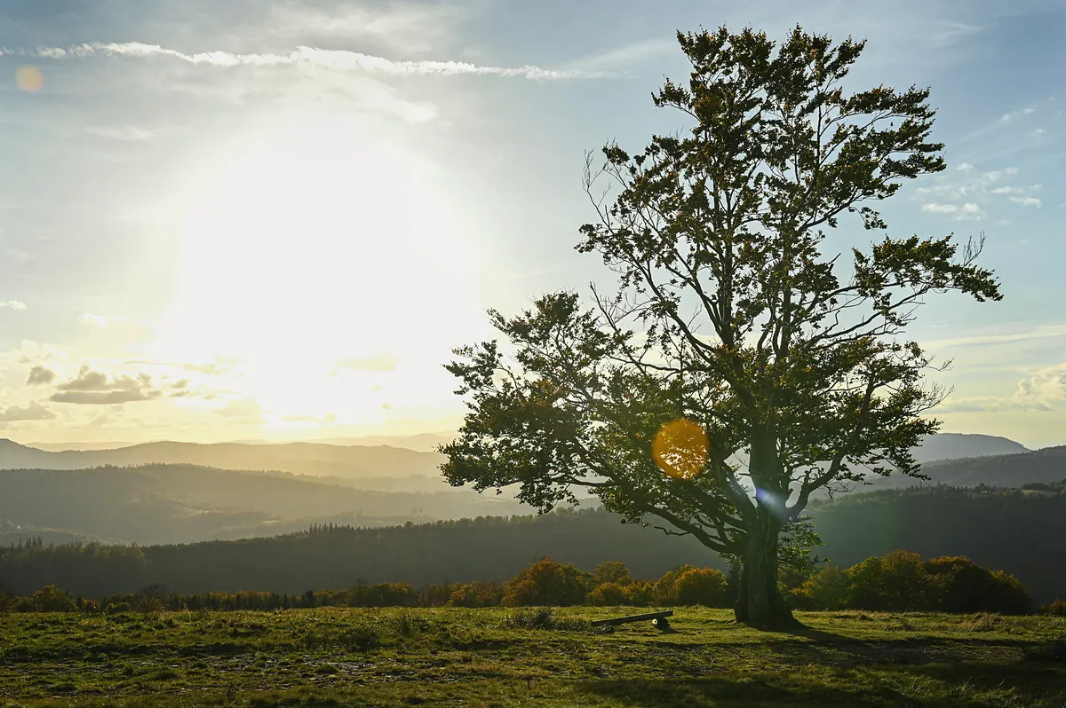
Hala Jaworowa, Brenna: a lone tree against the low sun1 / 21
Photos 21
Fog and inversions
Calm, clear mornings after a cold night: look down on the valley from above it.
The Beskid Mały mountains1 / 14
Photos 14
Snow, rime and the blue hour
After a frosty night, before the sun reaches the trees.
Malinowska Skała, Szczyrk: bare trees in the snow at sunset1 / 20
Photos 20
The night sky
A moonless night, away from the lamps of the town; a tripod on firm ground.
Szczyrk: stars over snow-laden spruces at night1 / 9
Photos 9
The viewpoints
The summits and meadows of the marked trails: wide views for a phone held level.
From the top of Skrzyczne: the valley and the ranges1 / 11
Photos 11
The town from above
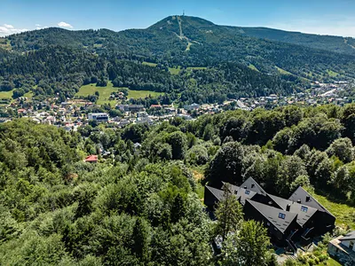
Szczyrk and its neighbours seen from the slopes and from the air.
A panorama of Bielsko-Biała1 / 3
Photos 3
Forest and detail
Close things that a phone does well: bark, leaves, a stream, a trail mark.
A forest near Pilsko, Beskid Żywiecki1 / 11
Photos 11
Photographers at work
What the patient ones carry, and where they stand.
A walker photographing the sunrise from a snowy ridge, in the Beskidy1 / 4
Photos 4
Fog over the valley
Details
Fog lying in the valley while the summits stand in the sun is a temperature inversion: on clear, windless nights under high pressure, cold air sinks into the valleys and the air above stays warmer.
It is most likely from November to March and shows best early in the morning, just before sunrise; snow on the ground helps. The Beskidy, with Skrzyczne above Bielsko-Biała, are named among the places to see it.
Nobody can promise it: look at the valley from the balcony at first light, and if it is white, go up.
Viewpoints on the trails
Only places on the marked trails; what you see is as the sources describe it.
Klimczok summit, 1,117 m
blue from the sanctuary, then the black spur
The open view is to the south-east: the Tatra peaks above the Beskid Żywiecki.
Details
Trees now hide most of the old panorama; the open view is to the south-east, where the Tatra peaks rise above the ridges of the Beskid Żywiecki. A sunrise direction in winter.
The trail to Klimczok, with Skrzyczne across the valley
on the way up to Klimczok
From the trail up to Klimczok: Skrzyczne and its mast, across the valley of Szczyrk.
Details
From the trail up to Klimczok, Skrzyczne with its mast stands across the valley of Szczyrk (two licensed photos in the gallery were taken there in October 2025).
A head torch and a whistle: they help if dusk or fog catch you on the trail.
A charged phone, a paper map and your ID: there is not always a signal.
Water, a thermos of tea, sandwiches and something sweet.
A spare fleece and a rain jacket; broken-in ankle boots.
In winter: poles and microspikes for icy paths.
For the camera: spare batteries kept warm in an inside pocket (cold drains them), a lens cloth, and a small tripod for the blue hour.
Respect for private land
Many trails around Szczyrk cross meadows and farmland that belong to local families: stay on the marked path, leave gates as you find them and keep off mown hay.
A private forest owner may close a forest with a “Zakaz wstępu” (no entry) sign; respect it (Polish Forest Act, art. 28).
Houses, gardens and people are not part of the view: ask before photographing anyone, and do not photograph into windows.
In the forest the law forbids noise, fires outside marked places and letting dogs run free (Forest Act, art. 30).
The residence sits on the edge of the Beskid Śląski Landscape Park. Deer, foxes and wild boar live in its forests, and so do the mountain birds our apartments are named after. You may see them if you are quiet and patient; they should never notice you.
WhereIn the house
When
The red deer rut
The second half of September, for about three weeks, from dusk.
How longAn hour or two
How muchFree
Who forFor quiet walkers
A story
Dusk, and something moving
The forest begins at the edge of the residence, and it is not empty. Deer, foxes and the birds your home may be named after live in it, and they keep their own timetable: dawn and dusk are theirs.
Read the story
Walk the marked trail in quiet clothes and stop often. In the second half of September the red deer stags call from dusk until after sunrise, for about three weeks; you will hear them long before you see anything.
Bring a long lens and patience. No flash at night, no recorded calls, the dog on a lead. Seeing one is luck, not a plan.
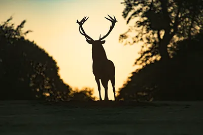
A red deer stag against the evening sky1 / 20
Photos 20
Details
In the forests of the landscape park
Red deer and roe deer. Both are common in the landscape park. In the second half of September, for about three weeks, the red deer rut: stags roar on meadows and forest clearings, mostly from dusk until after sunrise.
The fox. The park lists the fox among its predators, with the wolf and the lynx; the brown bear is only a rare visitor.
Wild boar. Common in the park’s forests. Give sows with piglets a very wide berth.
The fire salamander. Black and yellow, and often seen on the paths on rainy days; one of 13 amphibian species in the park.
Black, with a lyre-shaped tail; at dawn in spring the males display. Very rare, and strictly protected.
Details
Black, with a lyre-shaped tail: at dawn in spring the males gather on open ground to display, bubbling and hissing. Now very rare in the Polish mountains, and strictly protected.
Easiest to see in winter, small flocks among the fruit; the male’s breast is rose-red.
Details
For two hundred years Polish bullfinches bred almost only in the mountains. Easiest to see in winter, when small flocks search the trees for fruit; the male has a rose-red breast.
A summer raptor of the Beskid forests that lives on wasps and bees.
Details
A summer raptor of the Beskid forests that lives on wasps and bees, digging out their nests; it arrives in May and leaves for Africa at the end of summer.
An eagle of forest edges and wet meadows, here from April to September.
Details
An eagle of forest edges and wet meadows, brown and quiet, here from April to September before it flies to Africa for the winter; its high, yelping call carries far over the valleys.
Keep your distance: if an animal changes what it is doing because of you, you are too close. Use a long lens, not your feet.
Stay on the marked trail and keep quiet; the law forbids noise and disturbing wild animals in the forest.
Keep your dog on a lead: letting dogs run free in the forest is against the law.
Never feed animals, and never touch a fawn lying still in the grass: its mother is nearby.
Do not play recorded calls to the birds, and do not use a flash at night.
Never search for nests or dens. If you find a golden eagle’s nest, walk away quietly. It can be reported to the Regional Directorate for Environmental Protection (RDOŚ), which protects a zone around it.
In the rut and in the breeding season (spring and early summer), give the animals more room than usual.
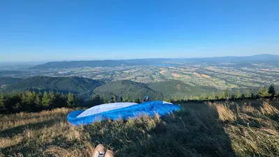
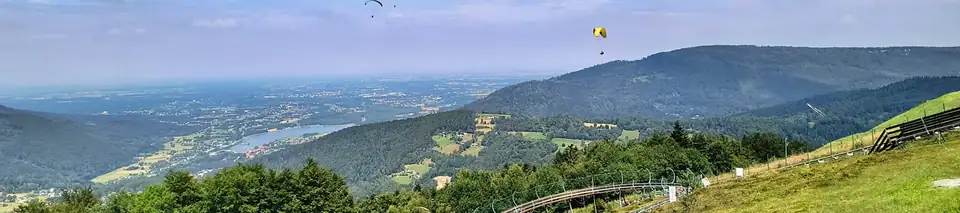
You do not have to be a pilot. On a tandem flight the school’s pilot flies; you are the passenger. You take off from the summit of Skrzyczne, above your door, or from Góra Żar at Międzybrodzie Żywieckie.
On a good morning the top of Skrzyczne is busy with people laying bright cloth out on the grass. They wait for the wind, take a few steps down the slope, and the mountain lets them go.
Read the story
You can go with them without learning anything first. One school is at home in Szczyrk itself and flies mainly from the summit of Skrzyczne, about fifteen minutes in the air, seven days a week in the summer season; it asks only for comfortable clothes and shoes. Another flies from Góra Żar and from Skrzyczne, lends the helmet, and asks for boots that hold the ankle, mountain boots best of all.
The wind has the last word, not the school and not you. A flight is agreed for a day and confirmed by phone before you set out, and a morning that looks perfect from the terrace can still be a morning to stay on the ground. That is part of what the flight is.
Our own photo: a wing laid out on a Beskid launch meadow, the valley below1 / 9
Photos 9
Who flies passengers
Szkoła Bezpiecznego Latania
ul. Myśliwska 84, Szczyrk
A paragliding school in Szczyrk since 1991: tandem flights from Skrzyczne, about 15 minutes each.
Details
A paragliding school founded in 1991, in Szczyrk. Tandem flights mainly from the summit of Skrzyczne, about 15 minutes each, seven days a week in the summer season; no preparation asked, only comfortable clothes and shoes.
ul. Górska 32, Międzybrodzie Żywieckie; an office on the summit of Góra Żar
Tandem flights from Góra Żar and from Skrzyczne, about 300 m from take-off to landing.
Details
Tandem flights from Góra Żar and from Skrzyczne, with about 300 m between take-off and landing. Passengers from 30 to 120 kg, in good general health; under 18 with a guardian’s written consent. The helmet is lent; boots that hold the ankle are required. Every booking is confirmed by phone before you come.
Three schools teach here, two of them in Szczyrk itself. A first course is a matter of days: a gentle slope, the school’s wing, and an instructor’s voice on the radio.
A pilot lifting the wing on a meadow at sunset
The first day has nothing to do with summits. It is a meadow with a gentle fall and a wing laid out behind you in the grass. An instructor shows how to bring it up over your head, and keep it there. You run, it lifts, you stop. Then again.
Read the story
On one of those runs the ground is no longer under your boots. A few metres, a few seconds, the voice on the radio saying hands up. The schools call this basic course Stage I: lectures, work on the ground, and at least twenty flights of your own from a low hill, each a little longer than the one before.
It suits anyone of fifteen or more in good general health; no school asks for a medical certificate, and two ask for a parent’s written consent under eighteen. By the schools’ own words the first course takes four to six days at one, four-day sessions at another, five days at the third, and longer when the weather keeps a day for itself. Stage II, the high flights, comes after, and with it the way to the state exam for the pilot’s certificate.
Not sure yet? A tandem flight is the easy way to taste it first: the same air, the same view, and somebody else holding the brakes.
Where to learn
Szkoła Bezpiecznego Latania
ul. Myśliwska 84, Szczyrk
about 2.1 km by road · about 4 min by car
Stage I in four to six days: lectures, and at least twenty solo flights from the school’s own slope.
Details
The basic course, Stage I, takes four to six days, as a rule from Thursday to Sunday: five hours of lectures and at least twenty solo flights from mountain slopes of no more than 150 m, around Szczyrk, where the school has its own training slope. From the age of 15, in good health; no medical examination. The school lends the wing, the harness, the helmet and the radio; you bring boots that hold the ankle and long trousers. Its 2026 courses ran from Easter to October. Stages II and III follow on the school’s trips abroad. Its site does not say whether lessons are given in English: ask the school.
Stage I, in a group of four or more, per person1900 zł
Stage I, one to three people, per person2200 zł
Official prices, checked . The equipment lent for the course is included. The list carries no date.
Stage I in four-day sessions, mostly over a weekend, on the school’s own slope near Szczyrk.
Details
Stage I in four-day sessions, most of them over a weekend, in groups of about ten at most: lectures and at least twenty flights from a hill of no more than 150 m, on the school’s own training slope, Wapiennik, near Szczyrk; the school’s bus takes you there. It teaches all year and asks for a booking at least four weeks ahead. From 18, or from 15 with a parent’s written consent; good general health, no medical certificate. The wing, the harness with its protector, the helmet and the radio are lent. Still deciding? Its introductory flights let you join the first one or two days of a course and make your first flights before you choose. Its site does not say whether lessons are given in English: ask the school.
Stage I, the basic course1990 zł
Introductory flights, one to two days800 zł
Official prices, checked . The school’s equipment and the insurance for the course are included. The list carries no date.
Stage I in five days, on Góra Żar or Góra Matyska as the wind decides, the instructor on the radio.
Details
Stage I in five days: the theory, handling the wing, take-off and landing, and twenty solo flights from slopes of up to 100 m, on Góra Żar when the wind is from the south and on Góra Matyska when it is from the north. The instructor stays with you on the radio and the school drives you up to the slope. Stage II, ten flights from at least 200 m, takes three or four days more: the two together about eight or nine days, by the weather, and then the exam for the pilot’s certificate is open to you. From 15 with the parents’ written consent; no medical certificate. The full equipment is lent. Its 2026 Stage I courses were in July and August. Its site does not say whether lessons are given in English: ask the school.
Stage I, the basic course1899 zł
Stage II1999 zł
Official prices, checked . Training on the school’s equipment. The list carries no date.
1The dark startHalf past five, December, and the house is asleep. I close the door softly and the cold takes my breath for a moment. Above the roofs the sky is clear and full of stars; the snow on the spruces holds the little light there is. Head torch on, and the first steps up the slope are the loudest sound in the valley.
2The climbThe forest road climbs between pines bent under their load. My own tracks are the only ones. Higher, the trunks thin out and the mast on Skrzyczne stands above the trees in a grey breath of fog. I keep the camera in the jacket, warm, and walk; the light is not here yet.
3The waitOn the ridge towards Malinowska Skała the wind has swept the snow smooth and glazed the last trees with rime. I set the tripod low, out of the wind, and wait. Below, the valley is a lake of cloud; only the summits stand out of it. Twenty minutes, a thermos of tea, fingers that stop obeying. The blue of the sky turns pale at the edge.
4The lightAt twenty to eight the sun comes over the far ranges and the whole ridge goes from blue to gold in the time of one breath. The frost on the branches lights up; the snow between the trees is pink, then white, then simply bright. I take the frames I came for, and then I stop taking frames and just look.
5The way downDown through the forest, the fog thinning as the day warms, the first walkers coming up with the sun on their faces. By ten I am on the promenade by the Żylica, then at the door, and the sauna room downstairs is where the morning ends. The photographs can wait until the evening; the cold does not.
The Beskid Śląski are gentle hills, yet every year weather, ice and early dark catch walkers out. Save the numbers, install the app, and tell someone your plan.
A Land Rover of GOPR Beskidy with the rescue number 985 on its door, at the Mountain Rescuer Day in Krynica-Zdrój, 20221 / 3
Photos 3
The mountain rescuers of GOPR, photographed at the Mountain Rescuer Day in Krynica-Zdrój in 2022: a display of their kit, not the Szczyrk station.
RATUNEK is the free rescue app that GOPR itself recommends (Android and iOS). It sends the rescuers your exact position and your phone number, so they need fewer questions.
Install and set it up before you go: grant location access and check that GPS works.
When you call
Say where you are, what happened, how many are hurt and how they are, and give your name and number.
Never hang up first: the rescuer ends the call.
No signal and no battery? Signal with a whistle or a light six times a minute, pause for a minute, repeat.
Weather and daylight
Check the forecast before you leave: the weather on the ridges can turn in minutes.
GOPR’s Beskid Group shows current mountain conditions on its home page; the official forecast is IMGW’s.
In winter
The blue trail along the Skrzyczne chairlift is not advisable in winter: it shares the slope with skiers.
The green trail from Szczyrk to Skrzyczne is not recommended in winter without crampons.
The last climb to the Klimczok summit is short, steep and demanding.
The middle of the yellow trail from the gondola to Małe Skrzyczne is poorly marked.
Good habits
The colour of a trail tells you which trail it is, not how hard it is.
Tell someone where you are going and when you will be back; a short message is enough.
Turn back in time: in December the sun sets before four.
Your host knows these hills. Ask on WhatsApp whether a guided walk or a packed breakfast for an early start can be arranged. The answer will be honest, with help choosing the trail for the weather.





 Skrzyczne
 Klimczok
 Skrzyczne
 Klimczok
 Skrzyczne
 Klimczok
 Skrzyczne
 Klimczok